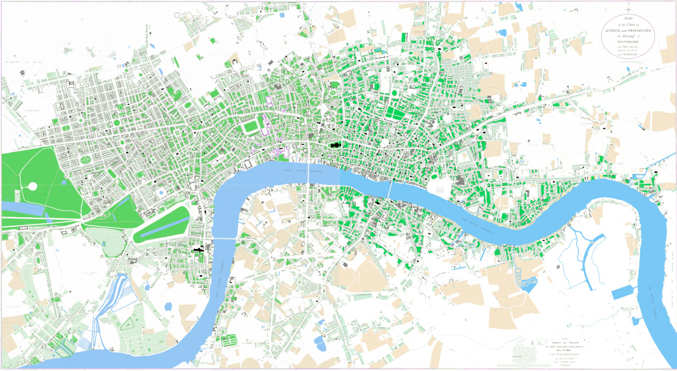
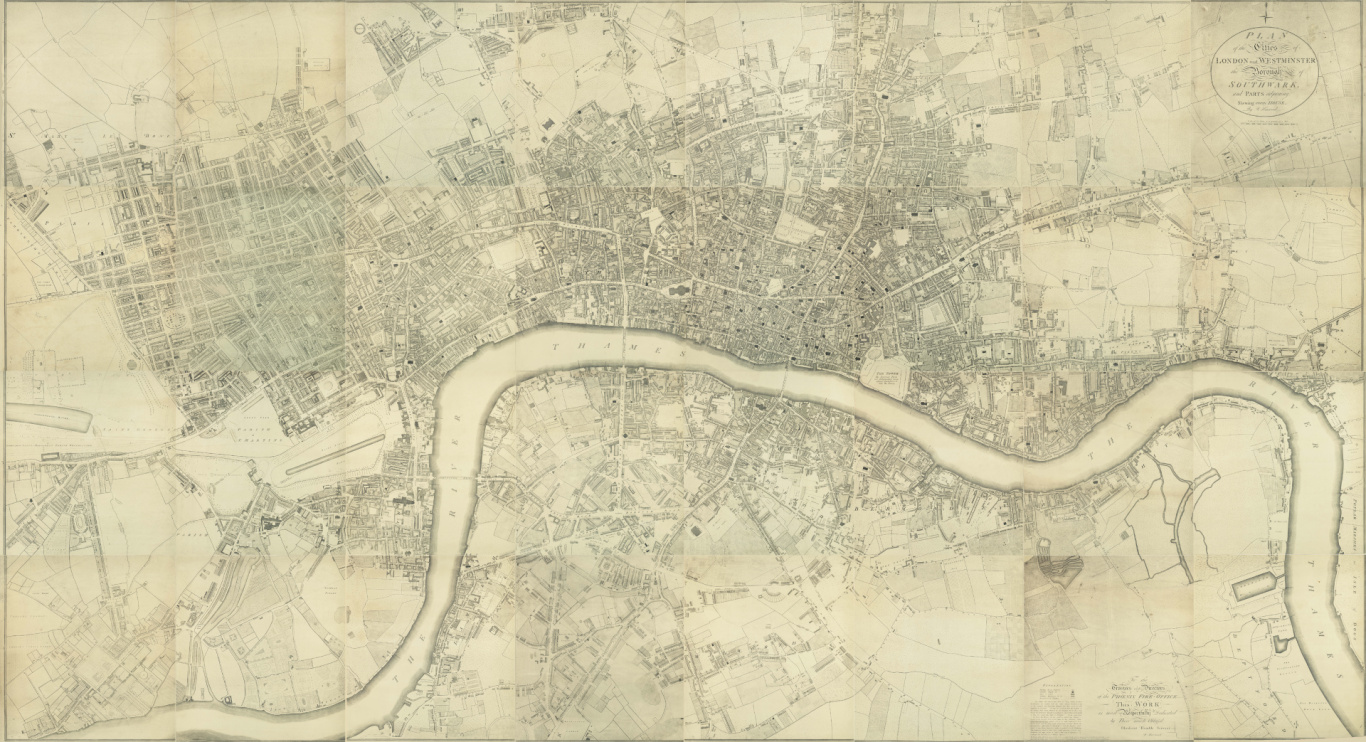
1799 map of London by Richard Horwood
Plan of the Cities of London and Westminster the Borough of Southwark and parts adjoining
Horwood’s map was published in 1799 after a survey lasting nine years. It is generally considered to be the most important map of London in the late 18th century and follows John Rocque’s equally renowned 1746 map of the city. At a scale of 26 inches to the mile it was engraved onto 32 copper plates and was the largest map of London at 13 feet by 7 feet. It shows the capital extending from the southern edge of Islington in the north, Kennington and Walworth to the south, Brompton to the west and Limehouse to the east. It shows all the alleys, courts and squares and even the house numbers of individual dwellings. It captures the metropolis in the early part of a period of spectacular growth which is later shown in William Faden’s revision of Horwood’s map in 1807, 1813 and 1819. This digital version allows the map to be examined in all its detail.
Richard Horwood
Remarkably little is known about Horwood. Born in about 1758 he died, in poverty, in Toxteth, Liverpool in 1803. Apart from a few estate maps the only maps he produced were those of London and a similar map of Liverpool. It seems likely that he undertook the London survey on his own, apart from one or two assistants. He wrote ‘I took every angle, measured every line’ in his London survey. Always seeking financial help for his endeavours he was finally supported by the Phoenix Fire Office.
Further information on the map
This digital re-drawing is based on a CD ‘Find your way round London in 1799’ which was produced by MOTCO in 2006. This company no longer exists but copies of the CD can still be found on the internet. I am indebted to Patrick Mannix, formerly of MOTCO Enterprises Limited, for help and advice in producing this digital redrawing. The book ‘A to Z of Regency London’, published by Harry Margary in 1985, has a reproduction of the original map with an introduction by Paul Laxton and an index to help you find individual streets. It is also available as publication No.131 by the London Topographical Society. The website www.romanticlondon.org is a research project by Matthew Sangster looking at the life and culture of London in the late 18th century London. It includes an online view of the map which can be compared with the map of modern London and a Google map image of the city.